In shortThe Valley of Fire scenic drive comes down to two paved roads. The spine is Valley of Fire Road, 7.0 miles booth to booth with a 35 mph limit; the branch north is White Domes Road, 5.5 miles at 25 mph and timed in the brochure at roughly 20 minutes from the Visitor Center to the pavement's end. You can be on both of them from sunrise until sunset, while the Visitor Center at the junction keeps a narrower 9 a.m. to 4 p.m. day.
7.0 milespark road, booth to booth
5.5 milesWhite Domes Road branch
20 minutesVisitor Center to the domes
from $99guided half-day drive
How the Valley of Fire scenic drive is laid out
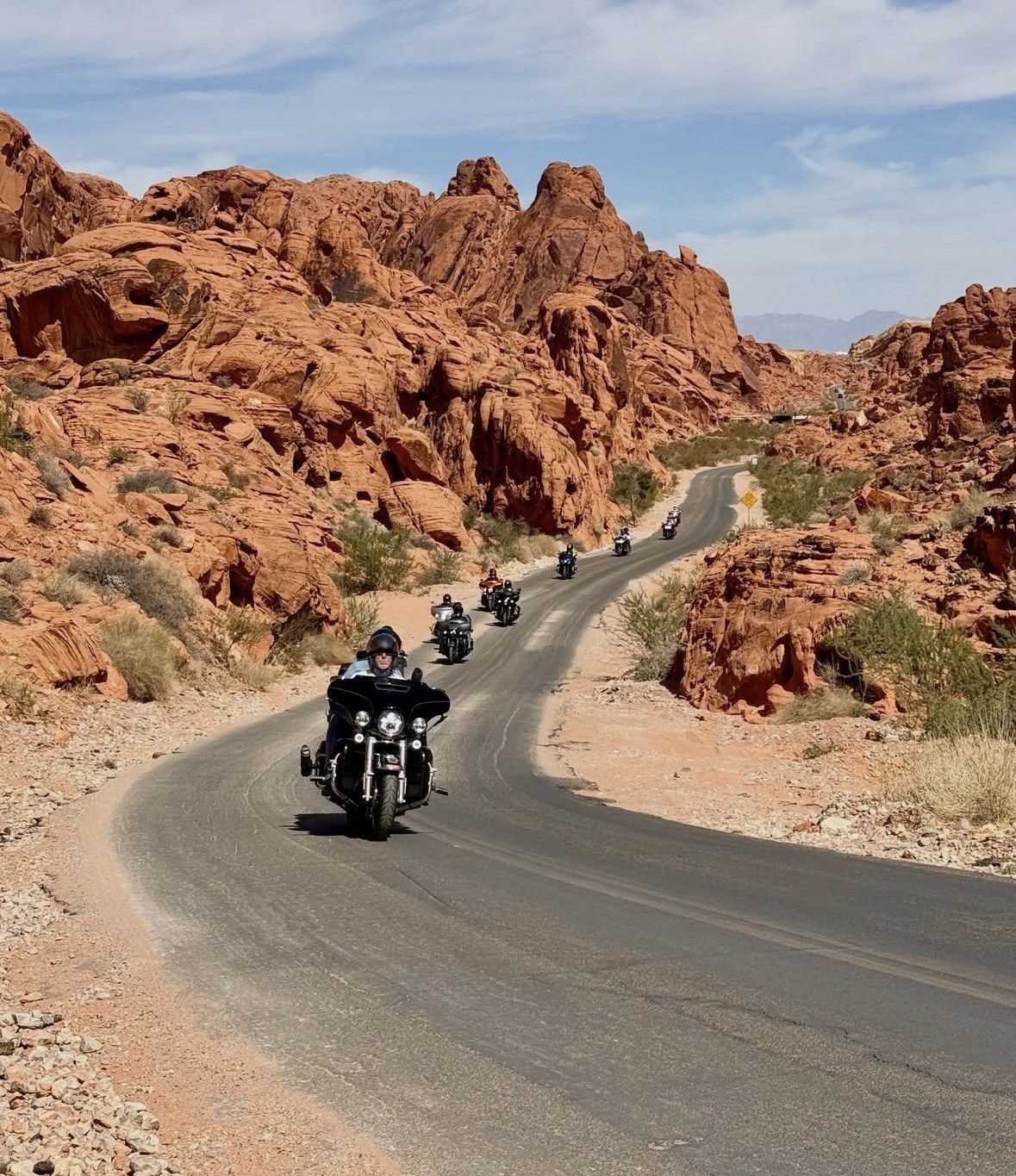
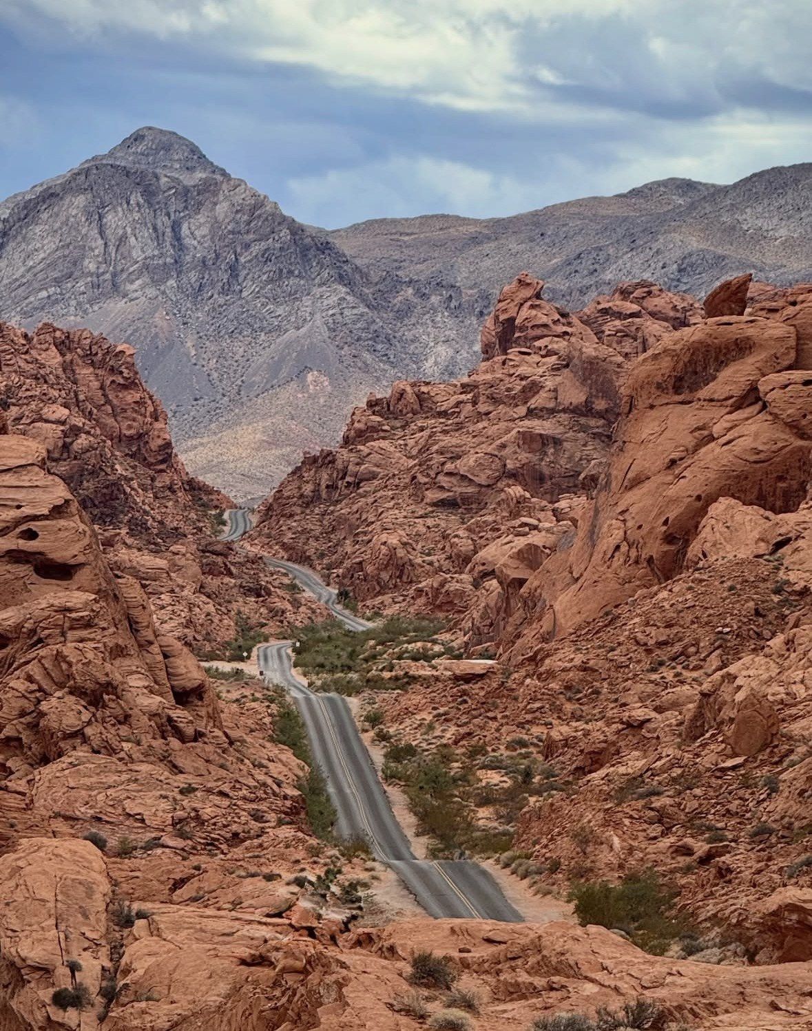
Valley of Fire Road is the spine: 7.0 miles of pavement between the West and East fee booths, posted at 35 mph, with most of the named rocks standing within a few paces of a marked lot. The Visitor Center sits roughly in the middle, at the junction where the north road leaves. That north road is White Domes Road, signed in places as Mouse's Tank Road, 5.5 miles at 25 mph to the domes at the end of the tarmac, which the park brochure times at about 20 minutes one way with no stops.
Everything on both roads is reached from a designated parking area, and pulling onto the shoulder is not allowed anywhere in the park. That matters, because the official map labels only three numbered lots along the whole White Domes corridor: P1, P2 and P3. Nevada State Parks puts current visitation at nearly a million people a year, so the trailhead lots run out of space well before midday.
Drive the north road first and work back along the main road afterwards. Parking is tightest at the walks that need a lot, Fire Wave from P3 and the White Domes loop at the end of the pavement, while the Beehives, Seven Sisters and the cabins can absorb a crowd and still take only as long as it takes to leave the car, look and get back in.
Small group half day drive from Las Vegas
Six hours from $99 along the park road and the roadside formations, with admission among the inclusions and no working out which entrance is open that day.
★ 5.0/5 · 4,125 reviews
Which end you start from in 2026
The entrance you use sets the order of the drive, and in 2026 it also depends on the day of the week. Since 3 August 2026 the West Entrance, the gate off Interstate 15, has stayed shut Monday to Thursday while crews add an entrance lane and a second fee booth, work the park expects to run through the end of 2026. That gate works to its usual hours on Fridays, Saturdays and Sundays.
Coming from the west on a Friday, Saturday or Sunday, you leave Interstate 15 at exit 75 and meet the Beehives and the two-mile loop road past Arch Rock and Piano Rock before you ever reach the Visitor Center. Monday to Thursday the park sends you to the East Entrance off State Route 169 or State Route 167, so the drive opens with Elephant Rock and the Petrified Logs, and the north road comes later in the morning, by which time P3 is busier.
One block of dates removes the drive altogether. The park admits nobody from Tuesday 1 December to Monday 14 December 2026 while maintenance runs, with normal operations back on Tuesday 15 December.
- Friday to Sunday: West Entrance open, drive runs west to east
- Monday to Thursday: the drive starts at the East Entrance, approached on State Route 169 or 167
- 1 to 14 December 2026: nobody is admitted, on foot or by car
Stopping at the Visitor Center first
The park asks every visitor to call in at the Visitor Center early, and on a driving day that is worth doing: the staff there know what the lots and the trails are doing that morning, and they also handle questions about where climbing is permitted. Exhibits cover the geology, the ecology, the prehistory and the park's own history.
The building is new. It opened on 22 November 2025 after an outlay of over $30 million, and what it adds to a driving day is a 10-minute orientation film, Valley of Fire: A Journey Through Time and Stone, narrated by William Shatner, with an outdoor amphitheatre seating 200 alongside. Doors on the centre and the gift shop swing at 9 a.m. and shut again at 4 p.m. every day, which is narrower than the sunrise-to-sunset window you have on the roads, and holiday dates can differ, so check on the day if that stop is the point of your trip.
Dogs stay outside the building; only service animals go in. Along the road and at the picnic areas they are fine on a leash no longer than six feet.
Mouse's Tank Road and the White Domes Road scenic drive
North of the junction the pull-outs come in a fixed order: Mouse's Tank and Petroglyph Canyon, then Rainbow Vista, then the signed Fire Canyon Road spur to the Silica Dome overlook, then lot P3, then the White Domes parking area where the pavement ends. The spur is the one people drive past. Take the turn, for the view over the deep red of Fire Canyon; the park brochure also names it as the Star Trek Generations filming location, and the Nevada Film Office lists the park for that title and for Total Recall.
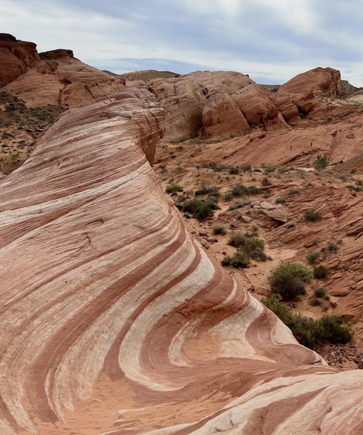
Fire Wave breaks the drive-and-look pattern, because it cannot be seen from the road at all. The walk is 1.5 miles out and back from P3, five miles north of the Visitor Center, which park staff put at about an hour, over loose sand and rough ground that feels longer than the mileage suggests. Pink Canyon, also called Pastel Canyon, can only be approached from the same lot.
Between 15 May and 30 September the park authority closes its best-known routes as a heat-safety measure, White Domes Loop, Fire Wave and the Seven Wonders loop with Pastel Canyon among them, along with every trail over a mile. The north road stays open on those dates and is still worth driving for Rainbow Vista, the Fire Canyon overlook and the domes themselves; the 0.75-mile Mouse's Tank walk sits under the one-mile threshold and is not on the closure list. Shaded tables and restrooms stand near the Mouse's Tank trailhead and at White Domes, and those two lots, plus P3 and the overlook, are among the few places in the park where a phone signal is possible.
| Pull-out, in order north | What you see | Time out of the car |
|---|
| Mouse's Tank / Petroglyph Canyon | Petroglyphs along the canyon walls and the natural rock basin that can hold water for months after rain | 0.75 mile round trip on sand |
|---|
| Rainbow Vista | Wide view over multi-coloured sandstone, the brochure's photo point | Minutes from the lot, or 1.0 mile round trip to the canyon viewpoint |
|---|
| Fire Canyon Road spur, Silica Dome overlook | Fire Canyon's deep red rock and the Silica Dome geology, the brochure's Star Trek Generations location | A short detour and a look from the overlook |
|---|
| Lot P3 | Trailhead for Fire Wave and the 1.8-mile Seven Wonders loop, the only access to Pink Canyon | About an hour for the 1.5-mile Fire Wave round trip |
|---|
| White Domes parking area | End of the pavement, the 1.1-mile loop with a slot canyon and the remains of a 1960s movie set, picnic area and restrooms | Minutes for the view, 1.1 miles for the loop |
|---|
Formations beside the main park road
Back on Valley of Fire Road the stops come quickly, and most are over in the time it takes to park, walk a short path and photograph the rock. Working through the official map's labels along these 7.0 miles you pass the Beehives, Atlatl Rock, Arch Rock, the historic cabins, Seven Sisters, the Petrified Logs and Elephant Rock, while Balancing Rock sits near the Visitor Center on a 0.4-mile round trip.
Atlatl Rock earns more than a glance. Its petroglyphs include a depiction of the atlatl, the spear-throwing tool, reached by a stairway to a viewing platform high enough to pick up a signal. A shaded picnic area with restrooms sits beside it, and the adjacent campground is the one with the RV hook-ups. Arch Rock and Piano Rock are on the two-mile loop road on the west side, next to the primitive campground.
The Civilian Conservation Corps built the stone cabins in the 1930s as shelters for travellers on the Arrowhead Trail, and they now work as a picnic area. Seven Sisters is a cluster of red formations a few steps from the tarmac, with shaded tables and restrooms alongside. At the east end, Elephant Rock is a 0.2-mile out-and-back from the road, or 1.25 miles if you take the loop. Climbing on the arches and on petroglyph surfaces is prohibited, Elephant Rock and Arch Rock included, and touching the carvings wears them away.
- Petrified Logs: a 0.25-mile loop, one of the quickest stops on the road
- Balancing Rock: 0.4 mile round trip near the Visitor Center
- Elephant Rock: 0.2 mile out and back, or the 1.25-mile loop
- Shade and restrooms when you want a longer break from the car: Atlatl Rock, Seven Sisters, the Cabins, the Mouse's Tank trailhead, White Domes
Light, hours and letting someone else drive
Early and late are when the sandstone does what you came for, and the park's hours bracket both ends. The gates take day visitors from sunrise and expect them back out by sunset, which fixes both ends of the drive for you. The only exception is a park-approved event, and vehicles still have to be clear of the site by 9 p.m. Save the day's sunrise and sunset times to your phone before you leave town, because a signal exists only at the entrances, the Fire Canyon overlook, P3, the White Domes lot and the Atlatl Rock platform.
Plan the last walk against that sunset deadline rather than the clock on the dashboard, and remember the Visitor Center shuts at 4 p.m. while the gates are still open. Fuel takes its own calculation: measured from the Visitor Center, the nearest is 15 miles one way and 18 miles the other, with a third option 52 miles off.
Guided departures from Las Vegas take over the admin part of this: which entrance is open on a Tuesday, where to park at P3 when the lot is full, how much road is left before the light goes. Six hours door to door from $99 buys the small group half day trip, rated 5.0 ★ (4125 reviews), which collects you at one of several points in town and counts Valley of Fire State Park admission among the inclusions. For a stop list and a pace you set yourself, the private adventure runs 6 to 10 hours from $180, rated 5.0 ★ (212 reviews), in a private vehicle with a local driver-guide, water, snacks and beverages covered; drivers who prefer their own car meet at the Moapa Travel Plaza by the Valley of Fire exit.
Questions people ask
Can you see Valley of Fire properly without hiking?
Yes, most of the famous rock stands beside the pavement. The Beehives, Arch Rock, Seven Sisters, the cabins, the Petrified Logs and Elephant Rock are all short walks from marked lots, and Rainbow Vista and the Fire Canyon overlook are viewpoints you drive to. The one thing a drive cannot give you is Fire Wave, which is invisible from the road and needs the 1.5-mile walk from lot P3.
How long does the whole scenic drive take?
Pure driving time is small. You have 7.0 miles of park road at 35 mph from one fee booth to the other, and White Domes Road adds 5.5 miles in each direction at 25 mph, a stretch the brochure puts at about 20 minutes from the Visitor Center to the end. Stops fill the day, from a few minutes at the Petrified Logs loop to about an hour for the Fire Wave round trip. Work backwards from sunset, since day visitors must be out by then.
Can I stop wherever I like for photographs?
No. Parking is restricted to the designated areas and stopping on the side of the road is not permitted anywhere in the park, including near Pink Canyon and below Elephant Rock. The official map marks lots P1, P2 and P3 along White Domes Road, with P3 serving Fire Wave and Pink Canyon. Drones and other remote-controlled aircraft are banned, so aerial shots of the drive are out.
Is there a loop road as well as the main road?
There is a two-mile loop on the park's west side, taking in Arch Rock and Piano Rock, with the primitive Arch Rock campground alongside and the Atlatl Rock campground, the one with utility hook-ups, nearby. It makes sense as an add-on when you enter from Interstate 15 at exit 75 on a Friday, Saturday or Sunday, and it is easy to miss when the Monday-to-Thursday closure pushes you to the East Entrance.
Does the drive still work in summer?
The roads stay open, which is why a vehicle-based visit is the realistic summer plan. From 15 May to 30 September the park authority closes White Domes Loop, Fire Wave, the Seven Wonders loop with Pastel Canyon and every trail over a mile as a heat-safety rule, and it does not recommend hiking above 85 F (29 C) in any month. Summer highs commonly pass 100 F and can approach 120 F, so carry water; supply inside the park is limited.
Read also