In shortThe things to do in Valley of Fire State Park sit along two roads. Valley of Fire Road covers 7.0 miles between the fee booths, passing the Beehives, Atlatl Rock, Arch Rock, the stone cabins, Seven Sisters, the Petrified Logs and Elephant Rock. White Domes Road branches 5.5 miles north to Mouse's Tank, Rainbow Vista, the Fire Canyon overlook, Fire Wave and White Domes.
40,000 acresAztec sandstone, Mojave Desert
2,500 yearsAge of the petroglyphs
7.0 milesValley of Fire Road, booth to booth
5.5 milesWhite Domes Road branch
What to see in Valley of Fire, and where each stop sits
Nearly every stop here stands close enough to a signed lot that the walk from the car takes a minute or two. The things to do in Valley of Fire State Park split into two sets: the formations, rock-art panels and picnic areas strung along Valley of Fire Road between the West and East fee booths, and the viewpoints and loop trails on White Domes Road, which runs north from the Visitor Center junction and is signed in places as Mouse's Tank Road.
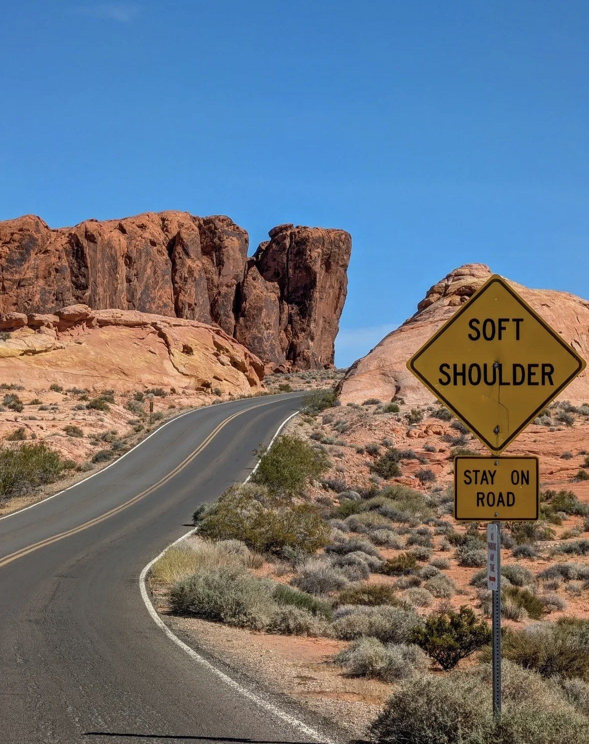
Designated lots are the only place you may leave a vehicle, and stopping on the shoulder is not allowed anywhere in the park. Visitor numbers are now close to a million a year, and the small lots serving the walking routes fill first on a cool-season morning, P3 above all. Pull-outs for the roadside rocks turn over fast, because most people are back in the car inside ten minutes.
| Stop | Where it sits | What the walk asks |
|---|
| Atlatl Rock | West-side loop road | Viewing platform above the panel |
|---|
| Arch Rock | West-side loop road | Visible from the road |
|---|
| The stone cabins | Valley of Fire Road | Steps from the picnic area |
|---|
| Seven Sisters | Valley of Fire Road | Beside the parking area |
|---|
| Petrified Logs | Valley of Fire Road | 0.25-mile loop |
|---|
| Balancing Rock | Near the Visitor Center | 0.4 mile round trip |
|---|
| Elephant Rock | East end of the park road | 0.2 mile out and back, or 1.25-mile loop |
|---|
| Mouse's Tank | White Domes Road | 0.75 mile round trip |
|---|
| Rainbow Vista | White Domes Road | 1.0 mile round trip |
|---|
| Fire Canyon / Silica Dome overlook | Fire Canyon Road spur | View from the overlook |
|---|
| Fire Wave | Lot P3 | 1.5 miles there and back, roughly 60 minutes on foot |
|---|
| Seven Wonders loop with Pink Canyon | Lot P3 only | 1.8-mile loop |
|---|
| White Domes | End of White Domes Road | 1.1-mile loop |
|---|
Stops along Valley of Fire Road
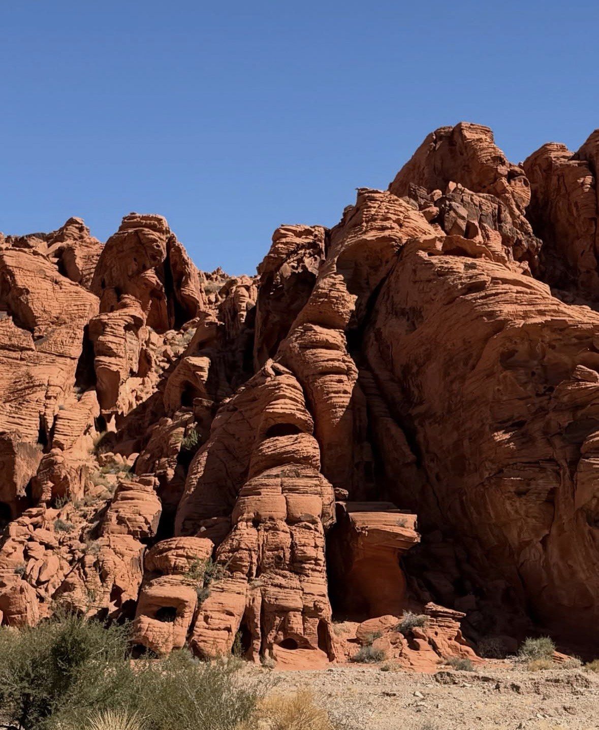
Entering from the west, the Beehives come first, one of the landmarks the official map prints along the park road. A two-mile loop road on this side swings past Arch Rock and Piano Rock, the shortest piece of sightseeing driving the park has.
Atlatl Rock holds the panel most people come for: centuries-old carvings that include the atlatl itself, the spear-throwing tool the rock is named after. A platform takes you up to viewing height, and this is one of the handful of places in the park where a phone signal is possible. Shaded tables and restrooms sit alongside, next to the campground that holds the utility hook-up sites. Do not touch the carvings or climb on them.
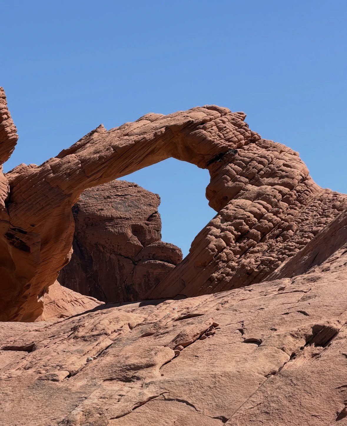
Arch Rock is visible from the loop road, which makes it a stop in any month: the Natural Arch Trail shuts from 15 May to 30 September, and Arch Rock itself is written out of that closure. Climbing on the arch is prohibited, here and on every other arch in the park.
The Civilian Conservation Corps built the stone cabins in the 1930s as shelters for travellers on the old Arrowhead Trail, and they serve today as a picnic area with shade and restrooms. The stop takes ten minutes or an hour, depending on whether you eat there.
Seven Sisters needs no walk at all: the cluster of red formations stands right beside the pull-out, and the day-use area there has shade, tables and restrooms. Leashed dogs are fine at picnic areas like this one, on a leash no longer than six feet.
The Petrified Logs loop runs 0.25 mile, the quickest walk on the park road, and Balancing Rock is a 0.4-mile round trip near the Visitor Center. Both slot into the gaps between the bigger stops.
Elephant Rock stands on the north side of the road at the east end, reached by trail from the East Entrance. The direct look is 0.2 mile out and back; the loop version runs 1.25 miles. Park in the designated area rather than below the formation, and stay off the arch.
Valley of Fire highlights on White Domes Road
Mouse's Tank is the first pull-out north of the junction and the best rock-art walk in the park. The 0.75-mile round trip follows Petroglyph Canyon past prehistoric carvings to a natural rock basin named for an outlaw who hid here in the 1890s; the brochure notes the basin can hold water for months after rain. At 0.75 mile it falls under the park's one-mile threshold, so it stays open through the hot months. The trailhead has one of the park's shaded picnic areas with restrooms, which makes it the practical lunch stop on the north road.
Rainbow Vista comes next, a 1.0-mile round trip out to a canyon viewpoint the brochure lists as a photo point over multi-coloured sandstone. Walk it slowly, or turn back early, because the view opens up well before the end.
A signed spur, Fire Canyon Road, drops east to the Fire Canyon and Silica Dome overlook, where you look across deep red sandstone and the dome's exposed geology. The park's own brochure identifies this overlook as the filming location for Star Trek Generations, released 18 November 1994. Cell service is possible here, which it is not at most of the park.
Two of the park's best-known stops hang off a single lot, P3, which sits five miles north of the Visitor Center. Fire Wave is a 1.5-mile out and back from here and cannot be seen from any pull-out, so the walk is the only way to look at it; park staff put it at about an hour and warn that loose sand and rough ground make it feel like three miles. Carry on around the Seven Wonders loop and the figure becomes 1.8 miles, taking in the Pink, or Pastel, Canyon section, which is reachable only from P3.
White Domes closes the road, 5.5 miles and roughly 20 minutes from the Visitor Center without stops. The 1.1-mile loop there runs through a slot canyon and past the remains of a 1960s movie set, and the lot has a picnic area and restrooms. The White Domes and Fire Wave pages on this site cover both trailheads in more detail.
Half day trip covering the main stops
Six hours from $99 across the roadside formations and the viewpoints on both roads, with water, snacks, lunch and park admission among the inclusions.
★ 5.0/5 · 4,125 reviews
Longer loops, and what closes in the hot season
Beyond the short walks, the park signs a handful of longer routes that turn a sightseeing day into a hiking day. The Pinnacles Loop runs 4.5 miles, the Prospect Trail 4.6, Charlie's Spring 4.7, the Natural Arch route 2.5 and Old Arrowhead Road 6.8 miles. Official guidance is that loose sand and rough ground make these feel longer than the mapped distance, so allow more time than the mileage suggests.
Between 15 May and 30 September the stop list above shrinks, because the park authority shuts its signature routes, and any trail longer than a mile, as a heat-safety rule. Hiking is not recommended once the temperature passes 85 F (29 C) in any month, trails are shut from sunset to sunrise, and the park calls hydration and electrolyte replacement critical while asking visitors to go easy on a limited water supply. The hiking hub page on this site lists the routes with their distances in one place.
- Off the stop list from 15 May to 30 September: White Domes Loop, Fire Wave, the Seven Wonders Loop, Pastel (Pink) Canyon, Pinnacles Loop, Prospect Trail, Arrowhead Trail, Natural Arch Trail with Arch Rock itself still open, and Charlie's Spring
- Open in those months: Mouse's Tank at 0.75 mile, the 0.25-mile Petrified Logs loop, the 0.4-mile Balancing Rock walk, the 0.2-mile approach to Elephant Rock
- Entry days through the end of 2026: West Entrance Friday to Sunday, East Entrance via State Route 169 or 167 from Monday to Thursday
- Nothing on this page can be done between Tuesday 1 December and Monday 14 December 2026, when nobody is admitted; the stops are back in use from Tuesday 15 December
The rock, the carvings and the Visitor Center
Everything you photograph here is Aztec sandstone from the Jurassic period, wind-blown sand left behind once the inland seas pulled back, spread over more than 40,000 acres of the Mojave Desert. The petroglyphs at Atlatl Rock and along Petroglyph Canyon were carved by the Basketmaker culture roughly 2,500 years ago, with Early Pueblo peoples following later.
The park's own timeline is easier to pin down. It opened as Nevada's first state park on Easter Sunday 1934 and received its legal designation from the legislature in 1935, the year the official park page gives for its establishment. The Civilian Conservation Corps had been at work since 1933, building the first facilities, the campgrounds and the stone cabins. About 8,500 acres were transferred to Nevada in the 1920s, and the park has grown past 40,000 since.
The Visitor Center belongs near the top of the stop list, and the park asks visitors to treat it that way. What you walk into is new: the building of over $30 million had its grand opening on 22 November 2025, and the stop now takes in a 200-seat outdoor amphitheatre and a 10-minute orientation film, Valley of Fire: A Journey Through Time and Stone, with William Shatner narrating. Exhibits cover geology, ecology, prehistory and history, and the staff there are the people to ask about conditions and about where climbing is permitted. Doors open daily from 9 a.m. to 4 p.m., narrower than the park's sunrise-to-sunset day use, and hours can differ on holidays.
Ranger-led events, and which tour covers the most stops
Park events are their own category and worth checking against your dates. Nevada State Parks runs self-guided outings such as new moon and full moon hikes with no reservation needed, and they are the only lawful way for a day visitor to be on a trail after sunset, with vehicles off site by 9 p.m.; normal vehicle entry still applies at the booth. Advanced ranger hikes go off the signed trails: one example is a 4-mile route beyond Mouse's Tank with 600 feet of gain, limited to experienced hikers aged 10 and over, with places booked by email to park staff. They run on the park's calendar and on its own terms, so check the dates before you plan a day around one.
Covering the widest spread of these stops in one day points to the small group half day trip: 6 hours from $99, rated 5.0 ★ (4125 reviews). Pick-up and drop-off at multiple locations in Las Vegas, a professional driver and guide, bottled water, snacks, a deli-style sandwich and Valley of Fire State Park admission sit among its inclusions. Readers who would rather be on the sandstone than looking at it through glass should weigh the guided hike instead: 5 hours from $129, rated 5.0 ★ (1696 reviews), with hotel pick-up and drop-off, a professional guide, snacks, water and the hike level set at booking. The ATV outing trades stop count for dust and engine time, 5.5 hours in total from $199, rated 4.5 ★ (228 reviews), covering all safety gear, hotel pick-up and drop-off, sandwiches, chips and bottled water. The itinerary page on this site puts these stops into a running order for the time you have.
Questions people ask
Can you see the main attractions without hiking?
Most of them, yes. Atlatl Rock, Arch Rock, the Beehives, the stone cabins, Seven Sisters and Elephant Rock all sit within a few paces of a lot, and Rainbow Vista and the Fire Canyon overlook work as driving stops with a short look at the end. Fire Wave is the exception: it is not visible from any pull-out and only reachable on the 1.5-mile walk from lot P3.
Which stops have shade, tables and restrooms?
Five stops double as shaded picnic areas with restrooms: Atlatl Rock, Seven Sisters, the Cabins, the Mouse's Tank trailhead and White Domes. If you plan to cook at one of them, the designated pits and grills are the only place a fire is permitted, and seasonal fire restrictions can override even that.
Can I fly a drone over the formations?
No. Every stop on this page is drone-free, since remote-controlled aircraft of any type are prohibited across the park, so frame your shots on foot. The Atlatl Rock platform, the Fire Canyon overlook and the White Domes lot are among the few places where a phone signal is even possible.
Are dogs allowed at the stops?
Dogs are allowed in the park on a leash no longer than six feet, which covers the roadside formations and picnic areas such as Seven Sisters. They may not go inside the Visitor Center, where only service animals are admitted. One more thing to watch with a dog along: the resident desert tortoise has protection under Nevada law, so nobody may touch, move or handle one.
Are there film locations you can visit?
Two titles are on the record. The Nevada Film Office lists Valley of Fire for Total Recall, released 1 June 1990, and for Star Trek Generations, released 18 November 1994, and the park brochure places the Star Trek Generations location at the Silica Dome Overlook. Park documents also confirm the remains of a 1960s movie set on the White Domes Loop without naming the film.
Read also